Back to the field
C. Post-Congress field trips
C1 – The Mississippian Kulm Basin of the Rhenish Mountains, western Germany – fauna, facies, and stratigraphy of a mixed carbonate-siliciclastic foreland basin.
Hans-Georg Herbig (Universität zu Köln), Hartmut Jäger (GeoResources STC, Leimen), Dieter Korn (Museum für Naturkunde Berlin), Michael Amler (Universität zu Köln)
03.-05.08.2019
Contact: herbig.paleont@uni-koeln.de, michael.amler@uni-koeln.de, University of Cologne, Institute of Geology and Mineralogie, Zülpicher Strasse 49A, D-50674 Köln, Germany
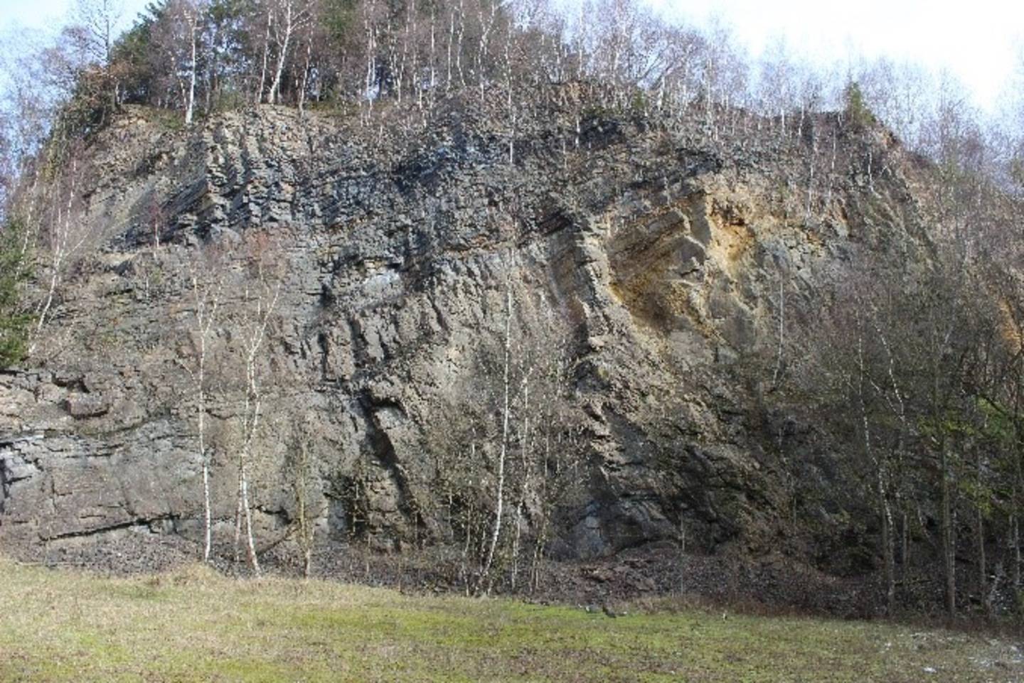
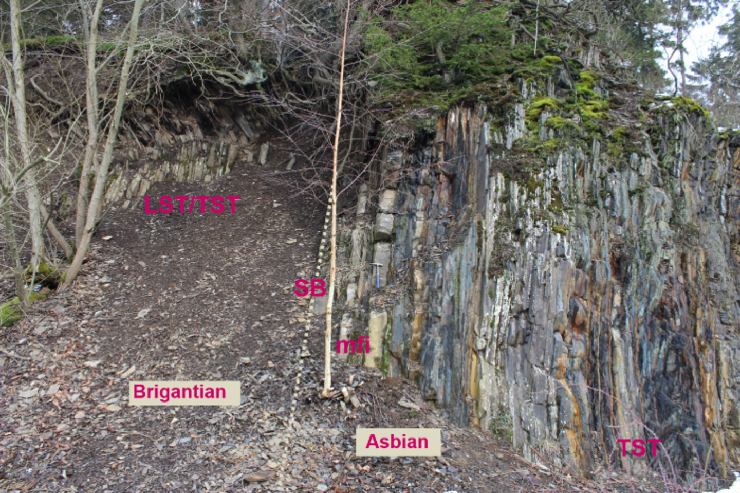
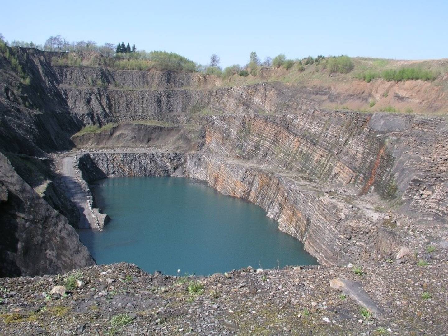
The Mississippian Kulm Basin of the Rhenish Mountains serves as a typical example of the central European and northwestern African Variscan deeper water foreland basins. However, subdivided into internal basins and swells it is internally differentiated, containing a surprising variety of sediments. They include ammonoid-bearing nodular limestone on swells, calciturbidites shed from not any more existing shallow-water sources, black shales, siliceous shales and bedded cherts in the starved basin, as well as shales, siltstones and greywackes shed from the advancing orogenic front. Based on decades of research, very detailed biostratigraphic subdivisions based on ammonoids, conodonts, and radiolarians were developed, notably for the lower Tournaisian and upper Viséan, which are generally applied in all the Variscan Kulm basins. Recently, the first application of sequence stratigraphy in such a complex deeper water basin showed that the lithostratigraphic succession is not random nor controlled by tectonics, but instead by sea level changes that only were overridden by the general succession from starved basin to orogenic sediments. Sequence stratigraphy now also enables a better correlation with the successions of the NW European shallow-water platform.
The field trip aims to present this succession based on many results, which in part still might have escaped the attention of the community. We particularly focus on litho- and biofacies, facies control, and stratigraphy, crossing the basin from its external margin in the west to proximal flysch facies in the east, which in part already is exposed within difficult to spot allochthonous nappes. Among others, the excursion will be visiting two outstanding sections exposing the Devonian-Carboniferous transition (Borkewehr, Drewer), the very well constrained Tournaisan-Viséan boundary in the Zippenhaus section, and the proposed Viséan-Serpukhovian boundary at the Wenne-Ufer section with its well documented and ammonoid-correlated conodont fauna. We also will visit the most important Mississippian black shale units in the Kulm Basin, i.e. the classical “Lower Alum Shale” that represents a world-wide event, an upper Viséan succession (Bromberg Fm) and the uppermost Visean-lower Serpukhovian “Upper Alum Shale”, which also is widely distributed throughout the Kulm Basin and beyond. In several places worldwide these units are targets for unconventional hydrocarbon shale plays. We will look at typical sedimentological pattern of each unit, combined with results from optical kerogen analysis and geochemistry, for a better understanding of the depositional systems, diagenesis and thermal history and the influence on the development of the resource potential of these shales.
Transport: Coach
Departure: Saturday, 03.08.2019, 08:30 a.m., Cologne University
Return: Monday, approx. 6:30 p.m., Cologne University
Number of participants: minimum 12, maximum 25
Costs (including hotels and all meals): 420 Euros
Clothing and type of outcrops: no special clothing required except for field boots. Bring along your private safety goggles, if possible. However, goggles, helmets, and safety jackets will be provided. Outcrops are active and abandoned quarries, natural and artificial outcrops along forest roads, slopes and river banks, easily reached by minor walking.
Suggestions: The field trip might be supplemented by pre-congress field trip A1 to the Ardennes that demonstrates time-equivalent successions of the carbonate platform adjoining towards the west of the Rhenish Kulm Basin. Pre-Congress field trip A2 allows comparison with a foreland basin on the southern side of the bilaterally symmetric European Variscan Orogen. On pre-congress field trip A4 the following Pennsylvanian development can be studied: basin progradation towards the northwest created the Subvariscan Basin, which after vanishing of the flysch facies was filled by paralic coal-bearing molasse sediments.
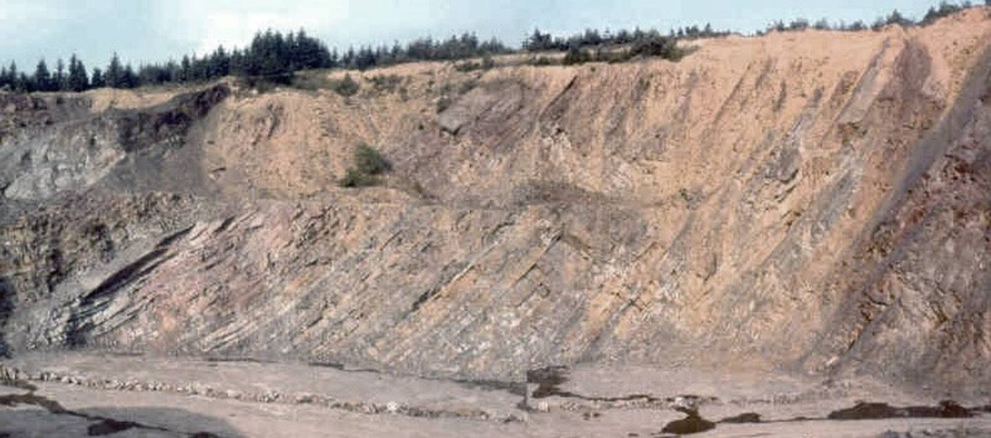
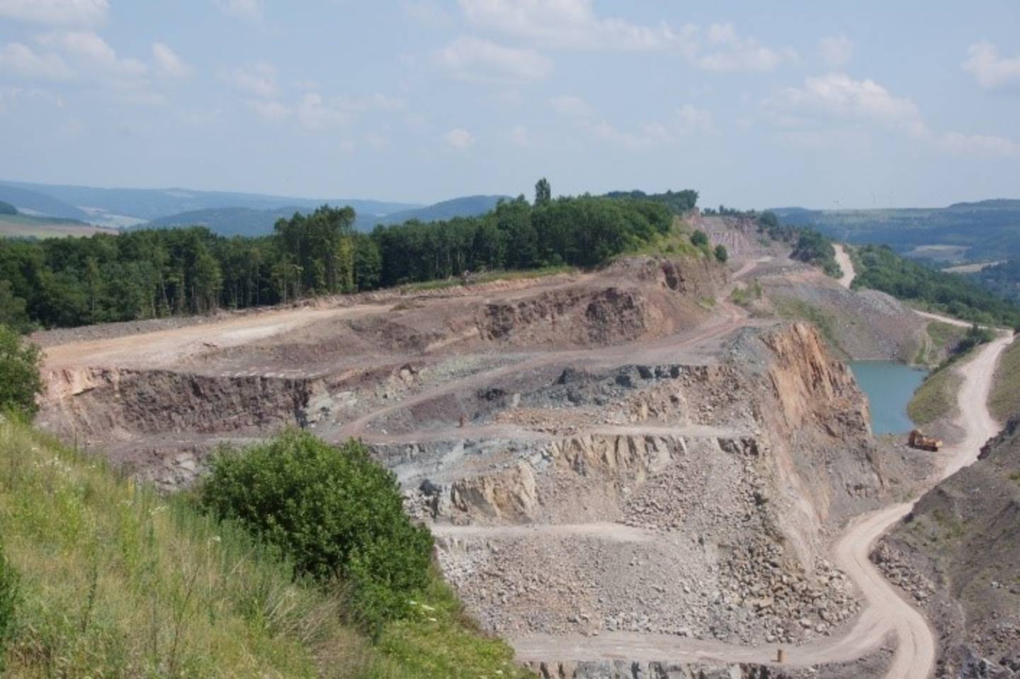
Dainrode quarry. Upper Viséan siliciclastic flysch sediment (greywackes, siltstones, mudstones) in the easternmost Rhenish Mountains were shed from the prograding orogenic front . They are time-equivalent to the sediments at Bromberg pictured above.
C2 – The Pennsylvanian–Permian of the Saar–Nahe Basin, southwestern Germany –an intramontane continental molasse basin of the Variscides.
Sebastian Voigt (Urweltmuseum Geoskop, Thallichtenberg), Thomas Schindler (Generaldirektion Kulturelles Erbe Rheinland Pfalz, Koblenz)
03.-05.08.2019
Contact: s.voigt![]() pfalzmuseum.bv-pfalz.de, Urweltmuseum GEOSKOP, Burg Lichtenberg (Pfalz), Burgstraße 19, D-66871 Thallichtenberg, Germany
pfalzmuseum.bv-pfalz.de, Urweltmuseum GEOSKOP, Burg Lichtenberg (Pfalz), Burgstraße 19, D-66871 Thallichtenberg, Germany
This trip focuses on fossil biota, facies and stratigraphy of one of the largest and best studied central Variscan basins of Europe. Its continental volcano-sedimentary succession measures about 8,000 m in cumulative thickness and covers early Pennsylvanian (ca. 320 Ma) to late Early Permian (ca. 280 Ma) rocks. Description of macrofossil content goes back to the mid-18th century and is world-famous especially regarding plants, freshwater sharks and tetrapods. The sedimentary fill of the Saar-Nahe Basin records in most detail the well-known Pennsylvanian-Permian paleoequatorial climatic shift from year-round hot and wet to monsoonal climate with extended dry seasons. First day of field trip will be dedicated to Pennsylvanian rocks of the formerly important hard coal mining Saar region. Limnic coal formation, coal tonsteins, plant macrofossils, horizons of the clamp shrimp Leaia and coarse-grained clastic intercalations as evidence of tectonic impulses are of main scientific interest in this part of the basin. Second day will be focused on fluvio-lacustrine sediments of the Lower Rot-Rotliegend (Glan Subgroup) of northwestern Palatinate area including the Odernheim black shales with its famousamphibian fauna. Of global importance is the recently discovered Remigiusberg fossil tetrapod hot spot with excellently preserved temnospondyl (Eryopidae, Dvinosauridae), reptiliomorph amphibian (Diadectmorpha) and pelycosaurian (Edaphosauridae, Sphenacodontidae) skeletons from around the Pennsylvanian-Permian boundary. Third day will be dedicated to the volcano-sedimentary rocks of the Upper Rotliegend (Nahe Subgroup) in the central and northeastern part of the Palatinate area. The focus will be on various products of an intense late Sakmarian intra-basinal magmatism (lava flows, lahars, laccoliths, maar-diatremes etc.), eolian-influenced playa red-beds as well as fossil biota which had to adapt to extreme environments. The field trip includes the visit of two museums (Urweltmuseum GEOSKOP and Paläontologisches Museum Nierstein) that offer remarkable insight into the fossils of the Saar-Nahe Basin.
Transport: Coach
Departure: Saturday, 03.08.2019, 08:00 a.m., Cologne University
Return: Monday, approx. 08:00 p.m., Cologne University
Number of participants: minimum 12, maximum 26
Costs (including overnight stay in a hostel, which is situated within the medieval castle Burg Lichtenberg / Pfalz; single and double rooms with private bath; Including all meals except at first evening): 310 Euros
Clothing and type of outcrops: no special clothing required except for field boots. Bring along your private safety goggles, if possible. However, goggles, helmets, and safety jackets will be provided. Outcrops are active and abandoned quarries, natural and artificial outcrops along forest roads, slopes and river banks, easily reached by minor walking.
Suggestions: The field trip might be combined with pre-Congress field trip A3, which demonstrates the classical continental succession of the Rotliegend in central Germany. However, the latter differs by the uppermost Permian ingression of the Zechstein Sea. Pre-Congress field trip A4 shows the time-equivalent development in the paralic environment of the Ruhr area.

C3 – The Pennsylvanian–Permian of the Southern Alps (Carnic Alps/Karavanke Mts.), Austria/ Italy/Slovenia – fauna, facies and stratigraphy of a mixed carbonate-siliciclastic shallow marine platform along the northwestern Palaeotethys margin.
Matevž Novak (Geological Survey of Slovenia, Ljubljana), Holger Forke (Millenia Stratigraphic Consultants), Hans-Peter Schönlaub (Vienna and Kötschach-Mauthen, Austria)
03.-06.08.2019
Contact: matevz.novak![]() geo-zs.si Dimičeva ulica 14, 1000 Ljubljana, Slovenia; holger.forke
geo-zs.si Dimičeva ulica 14, 1000 Ljubljana, Slovenia; holger.forke![]() gmx.de
gmx.de
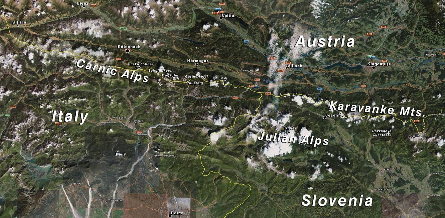
Excursion Day 1 Dovžanova Soteska (Lower Permian)
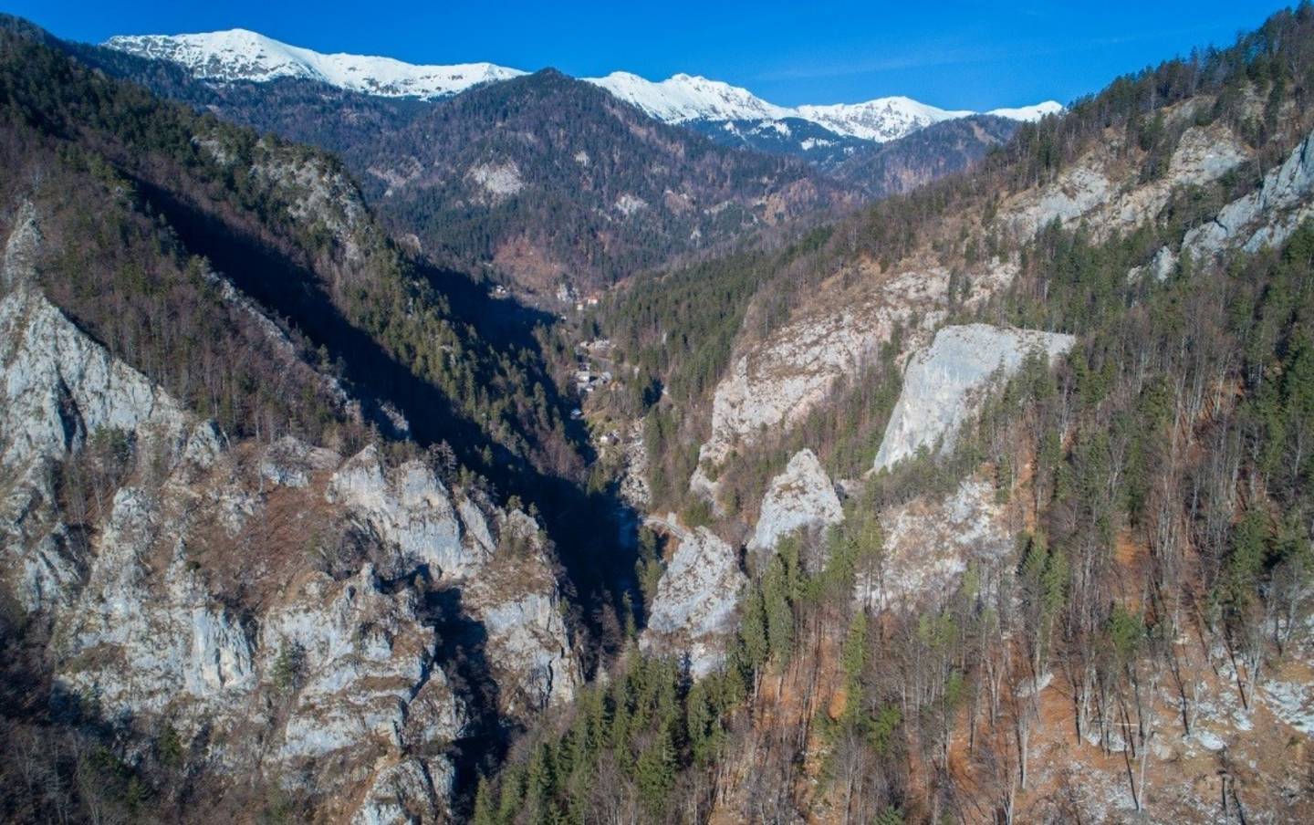
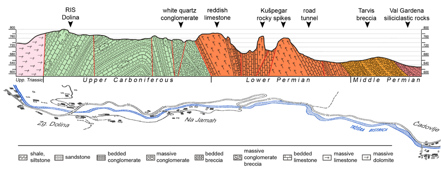
Aim of the excursion is to visit classical localities of Late Paleozoic sediments of Tethyan origin in Central Europe. Carboniferous/Permian rocks in the Southern Alps are among the earliest scientifically described and were discovered in the first half of the 19th century. The Dovžanova soteska (Dovžan’s Gorge) exposes the most complete section of shallow-marine fossil-rich Late Paleozoic beds in the Karavanke Mts.
Ever since the early studies of fusulinids and brachiopods by Schellwien (1898, 1900), corals and brachiopods by Heritsch (1933, 1938) and fusulinids by Kahler & Kahler (1937), the Dovžanova soteska has attracted attention of paleontologists as a type locality of large number of fossil taxa.
The section, although it is cut by several faults, displays an almost continuous development of cyclic, siliciclastic-carbonate deposition from a gently steeping ramp during Gzhelian into a reef-rimmed platform through Asselian and Sakmarian. Since the Gzhelian succession of fluvial to fan-deltaic conglomerates, nearshore storm regime dominated sandstones, bioturbated siltstones, and offshore algal buildups (Auernig and Schulterkofel Formations) is almost identical to the one in the better exposed sections in Carnic Alps (see Excursion days 2 and 3), our observations will focus on the predominantly carbonate, reef and lagoonal, Asselian-Sakmarian succession of Dovžanova Soteska Formation, Born Fm. and Rigelj Beds (Forke, 2002; Novak, 2007). On the walkway through the gorge, we will cross five regional fusulinid assemblage zones and stop at the most important fossil sites.
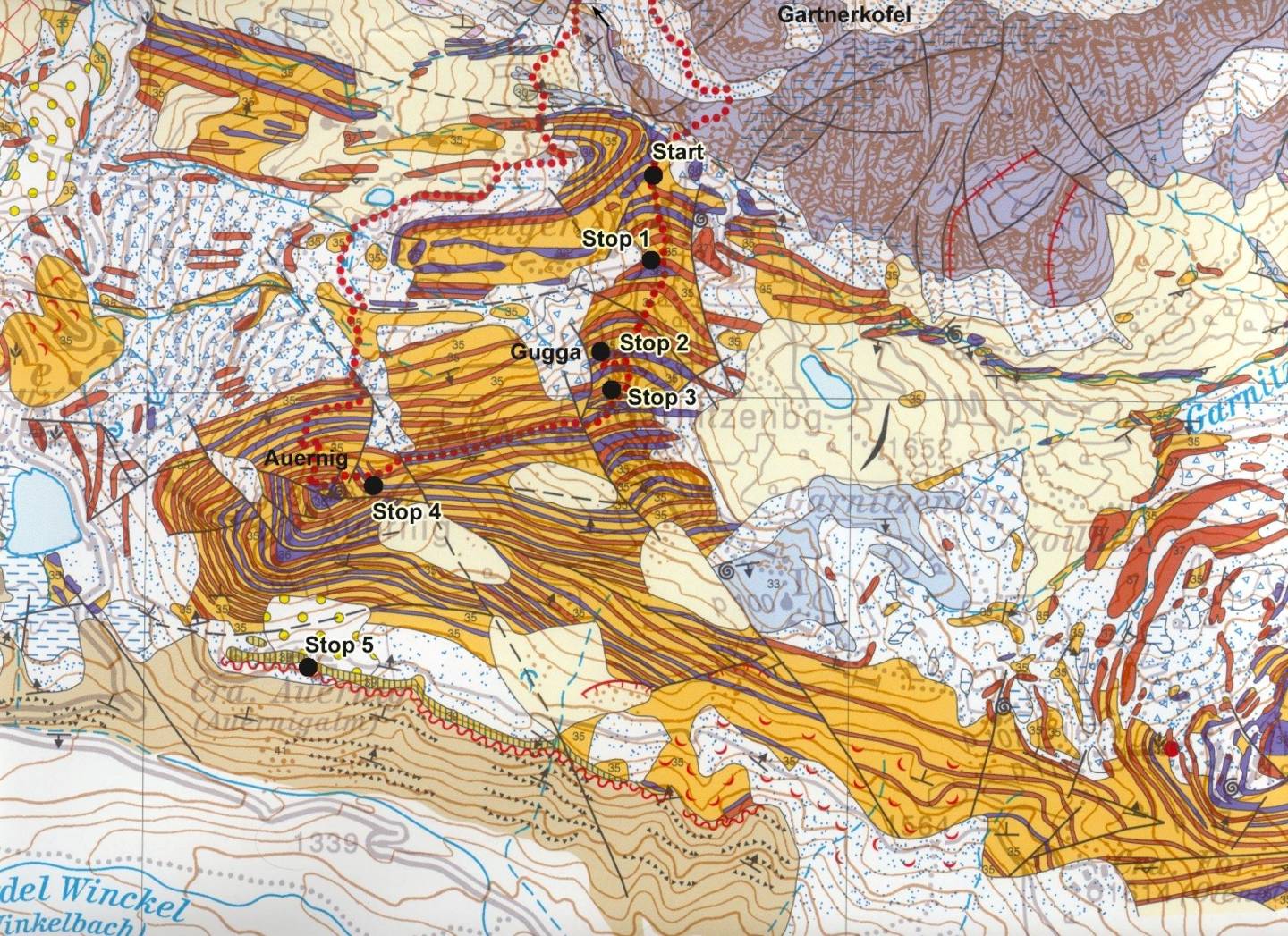
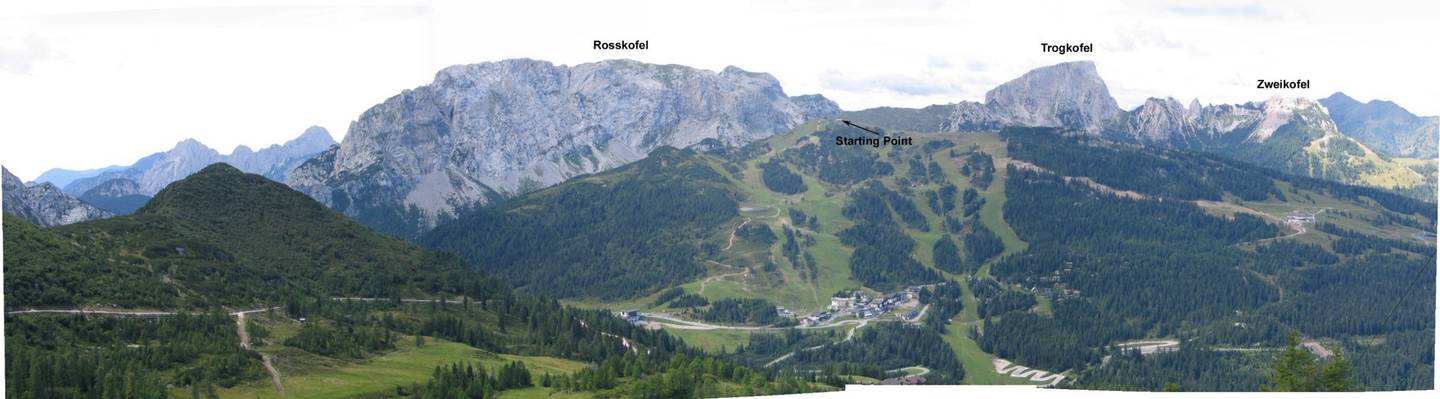
Excursion Day 2 Gartnerkofel - Gugga – Auernig (Upper Carboniferous)
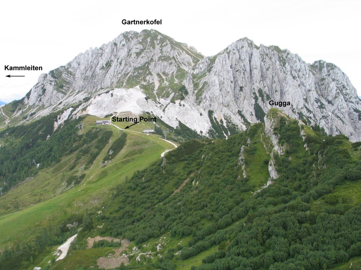
Excursion day 2 starts with an overview of the geology of the surrounding area with emphasis on the Late Paleozoic sequence. On the Kammleiten (1998 m) a scientific core was drilled in 1986 to analyze the P/T boundary (Gartnerkofel Drilling Project). The summit of the Gartnerkofel (2195 m) consists of Schlern Dolomite with a thickness of more than 500 m.

Typical Auernig cyclothems.
This locality represents one of the scientifically most interesting settings in the Carnic Alps. The Carboniferous succession at the western and southern flank of Auernig mountain with the repetitive alternations of conglomerates, sandstones, shales, and limestones has attracted geologists since the end of the 19th century. SCHELLWIEN (1892), FRECH (1894) and GEYER (1896) investigated this area and introduced letters, respectively numbers for the individual beds. SCHELLWIEN (1898) first studied the fusulinids from the Auernig section with several new species. The term „Auernigschichten“ was introduced by FRECH (1894). HERITSCH et al. (1934) lithologically defined and subdivided the Auernig Formation according to the predominance of limestone horizons into five members (“untere kalkarme, untere kalkreiche, mittlere kalkarme, obere kalkreiche, obere kalkarme Schichtgruppe”). SELLI (1963) introduced the terms Meledis, Pizzul, Corona, Auernig, and Carnizza as subdivision of the Auernig Formation, which are regarded as equivalents of those of HERITSCH. Abundant plant debris (with Stefanian flora) has been studied by FRITZ & BOERSMA (1990). Sedimentology and cyclostratigraphy have been discussed by KRAINER (1990) and SAMANKASSOU (2002).
The basal deposits at the contact between Pre-Variscan Basement and Post-Variscan sedimentary cover.
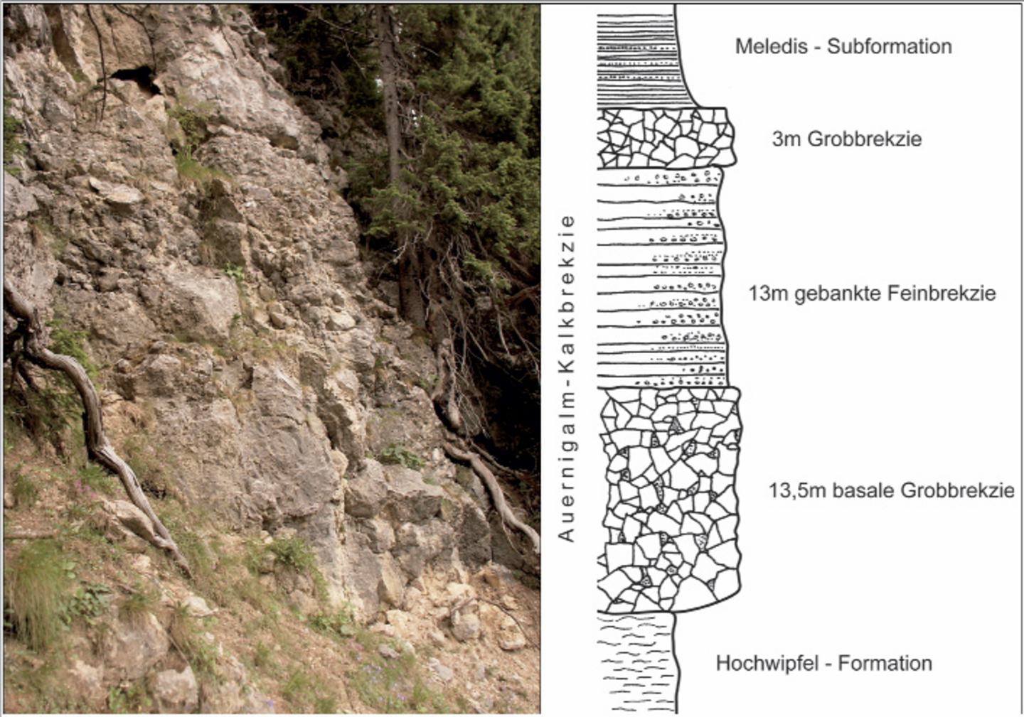
The Auernigalm Limestone Breccia consists of coarse and fine-grained clasts. The thickness of the breccia varies from 12 m on the lateral sides to more than 30 m in the central part (SE of the Auernigalm). Of particular interest are the uppermost parts of the limestone breccia, which yielded conodonts and sparse fusulinoideans
in the interstices. The presence of Idiognathodus cf. expansus, Swadelina ? cf. makhlinae, and Fusulina (Quasifusulinoides) sp. indicates at least a lower Kasimovian (Krevyakinian) age. The lense-like geometry of the Auernigalm Limestone Breccia between the underlying Hochwipfel Formation and the overlying Auernig Formation suggests an extensive fan deposit along the foothill of the escarpment of the Roßkofel-Malurch massif.
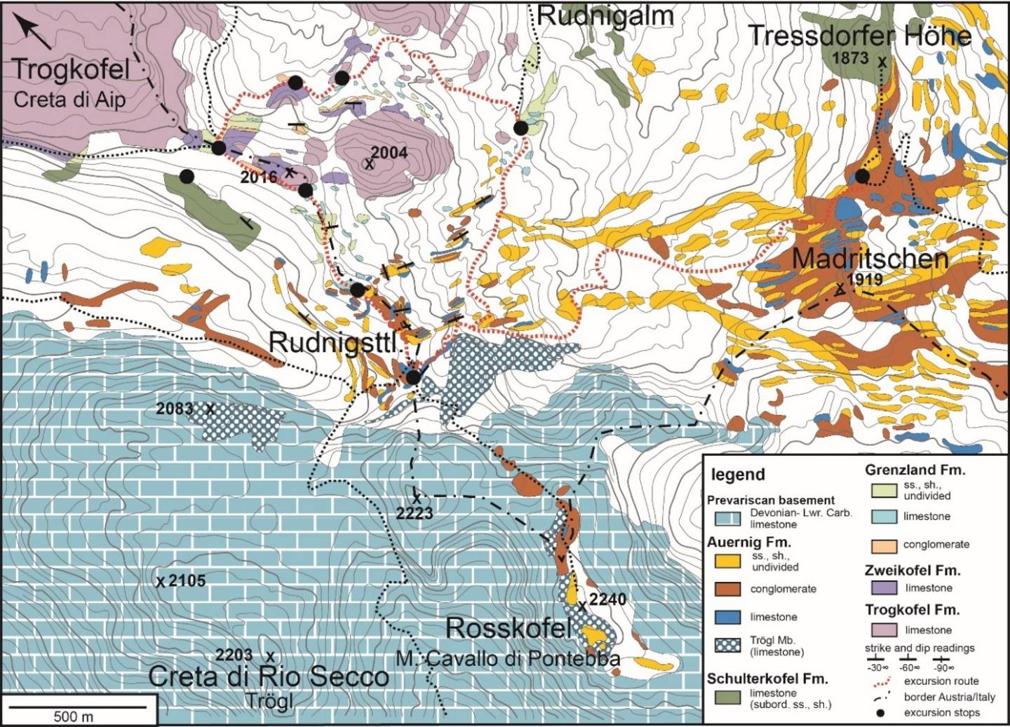
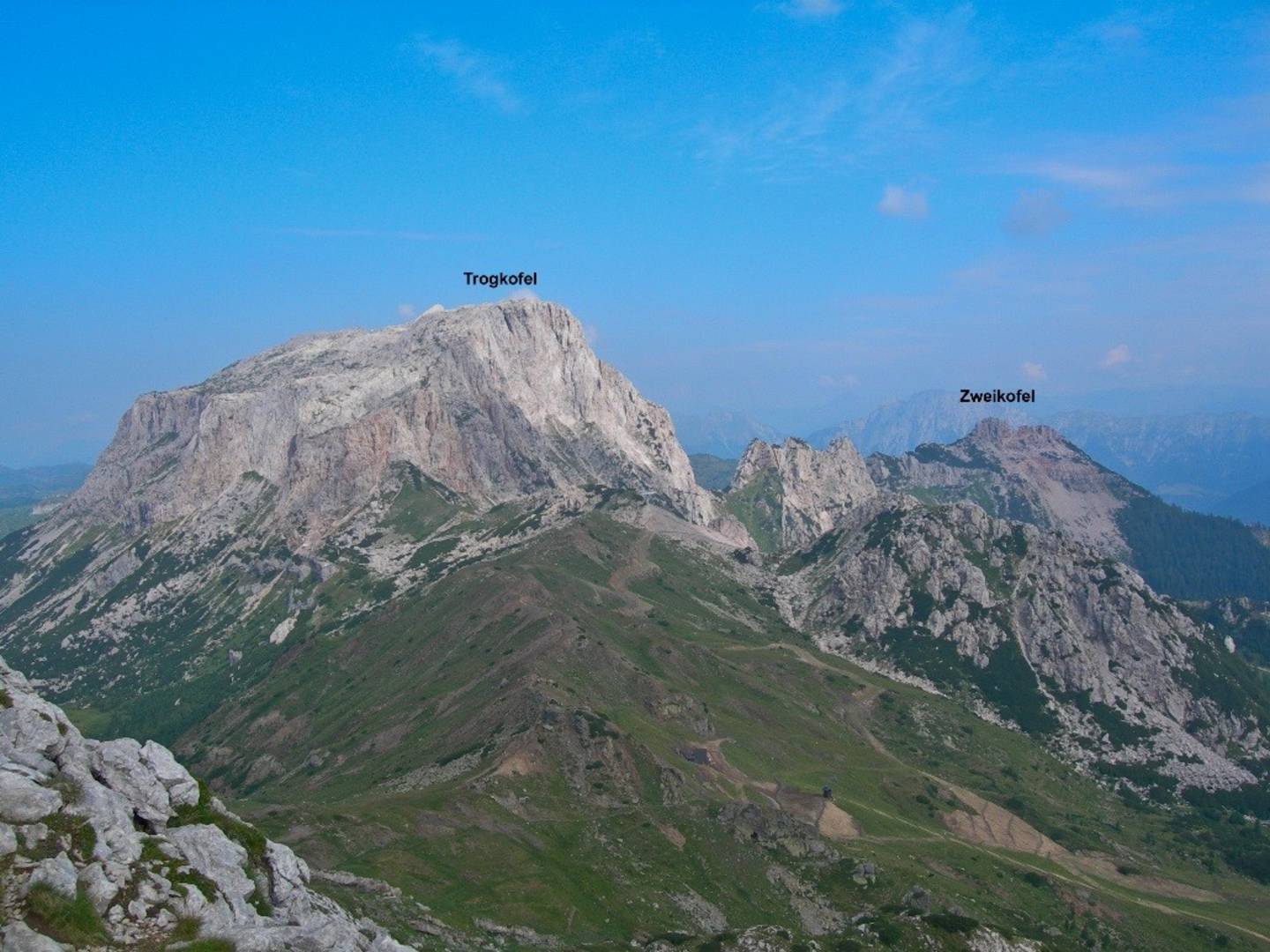
Excursion Day 3 Madritschen – Rudnig Saddle – Trogkofel (Lower Permian)
The third day starts at Madritschen with an overview of Lower Permian stratigraphy.
We will discuss the sedimentology, cyclicity, the various types of build-ups and changes in biota of the indivdual formations. Highlights are the distinct Anthracoporella mounds in the Schulterkofel Formation, the oncoid limestones with abundant larger benthic forams (e.g. Zellia) in the Grenzland and Zweikofel Formation and Archaeolithoporella reef limestone in the Trogkofel Formation.
Our walkway will lead us along the Rudnig saddle to the base of Trogkofel massif. On the way back through the Trogkar, we will pass the red limestones of Altitude 2004 m.
Suggested further reading:
FORKE, H. C., SCHÖNLAUB, H. P., SAMANKASSOU, E. (2006): Late Paleozoic of the Carnic Alps (Austria/Italy): Guidebook, Field Trip of the SCCS Task Group to establish GSSP’s close to the Moscovian/Kasimovian and Kasimovian/ Gzhelian boundaries, 31. July – 01. August 2006, Ber. Geol. B.-A., 70, 57 p., Wien.
SCHÖNLAUB, H. P., FORKE, H. C. (2007): Die post-variszische Schichtfolge der Karnischen Alpen – Erläuterungen zur Geologischen Karte des Jungpaläozoikums der Karnischen Alpen 1:12.500, Abh. Geol B.-A., 61, 3-157, Wien.
General information: The excursion will start on the 3rd August and end on the 6th August at Klagenfurt/Austria (optional Ljubljana/Slovenia). Travel from Cologne to Klagenfurt and back is not included, but might be jointly organised, when the registration of participants is completed. The transport to Slovenia (Dovžanova soteska) and the Nassfeld area will be conducted with Minibuses.
Accommodation will be arranged in a hotel near the Tröpolach/Nassfeld area. Hiking boots, rain jackets and warm clothing are required during the field trip. Hiking will be about 3-4 hrs per day at altitudes up to 1500-2000m. Passport (with valid Schengen visa) has to be carried at all times as the hiking path is close to the Italian/Austrian/Slovenian borders.
Number of participants: minimum 8, maximum 21
Costs (including transport with minibus, chairlift and accommodation (3 nights) with breakfast, dinner and field lunch, without transfer from Cologne): 580 Euros.